A large gap in the weather radar coverage of western Victoria, including the Wimmera, has been filled after the new radar facility near Rainbow was switched on for the first time yesterday.
The site for the new radar was announced in late 2018 with a site two kilometres west of Pullut, and about eleven kilometres south of the town of Rainbow, chosen after an extensive and detailed process to identify a location that would best serve both the Wimmera and the wider Australian weather radar network.
Construction work commenced on the site in June last year with the final piece, the radar itself, completed recently.
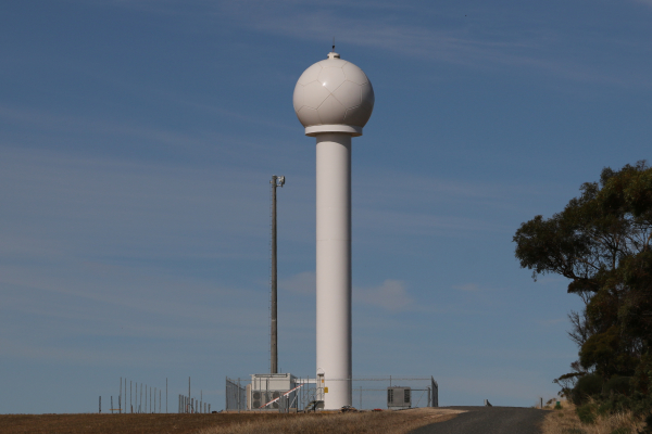
This site will provide world-class weather intelligence for the Wimmera Southern Mallee region and comprises a 22-metre high tower weighing 32 tonnes, a 5-metre high dome covering the radar dish, and supporting infrastructure including equipment hut, data communications link and back-up power supply.
Benefits for all
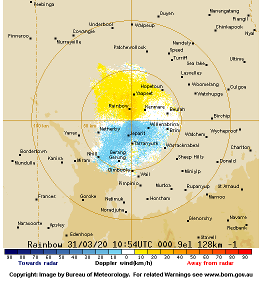
The Rainbow Radar is a C-band 1-degree dual polarisation Doppler radar, able to measure not just where particles are in the sky, but also how fast they are moving and what type of particle they are likely to be - raindrops, hail, bushfire plumes. Other information such as rain intensity and wind velocity will assist with flood and severe weather warnings, emergency services management, and general weather forecasting.
The improved weather forecasting services that will be provided through the information from this radar will provide significant benefits to the local and regional agriculture sector, along with aviation and other parts of the transport sector, emergency services, and the general public.
Farmers who have, until now, relied on radar sites at Mount Gambier and Mildura to assist with planning when to spray or spread fertiliser will now be able to access high-quality radar imagery taken in our backyard, providing more accurate data in real-time - and filling in what has been a radar blackspot.
Evaluation period
While the radar went online yesterday, it will undergo an evaluation period of twelve months to confirm its coverage is unhindered in all directions. The location is expected to provide good radar coverage with minimal impact on the radar beam from any obstructions and should provide a clear 360-degree view.
Images from the Rainbow Radar can be viewed on the Bureau of Meteorology website.
The radar project is a whole of community effort, supported by the Wimmera Development Association, funded jointly by the Victorian and Federal Governments and delivered and operated by the Bureau of Meteorology.
Below: Along with rainfall, the radar also records wind speed and direction.
|